
Type
TextualInversion
Publish Time
2023-11-02
Base Model
SD 1.5
Trigger Words
HaroldFiskMeander
Copy
Version Introduction
First release.
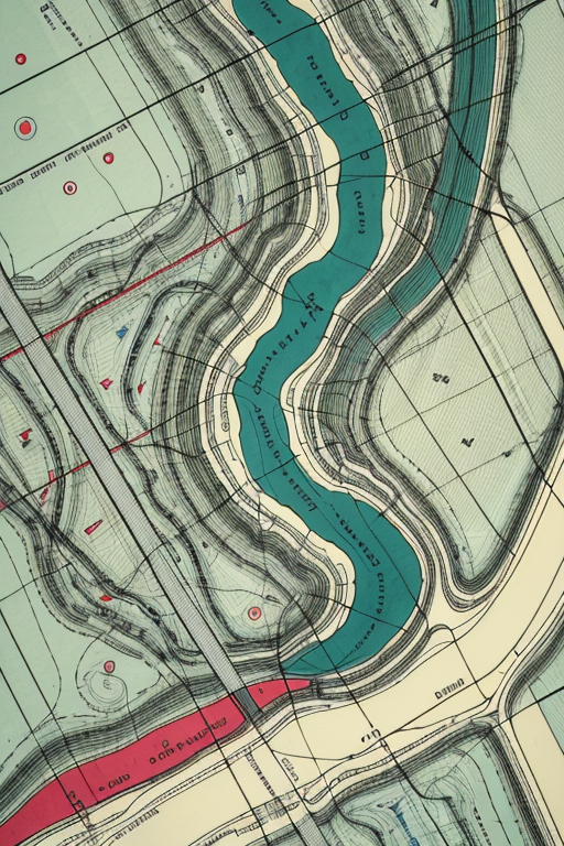
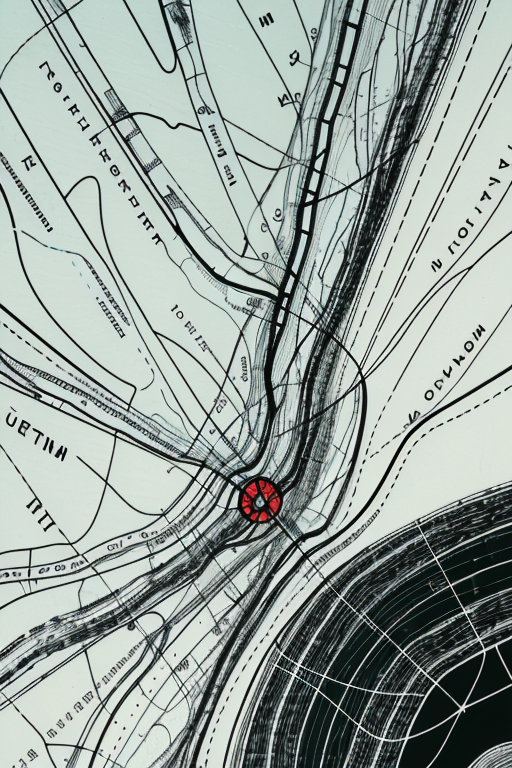
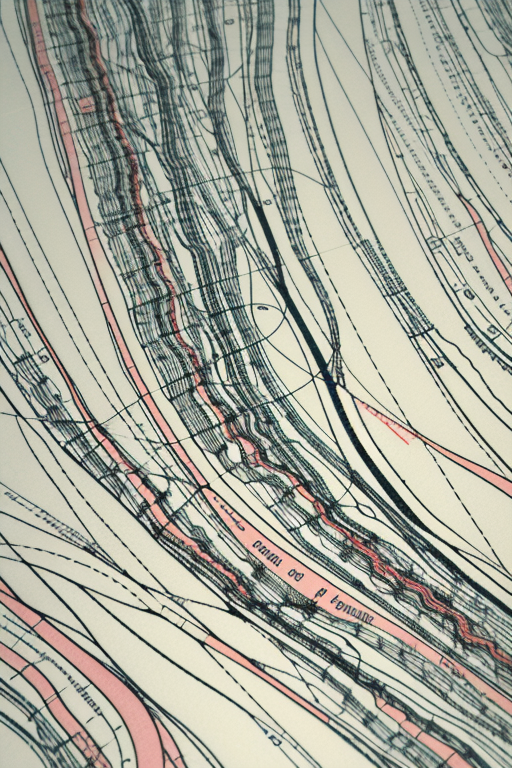
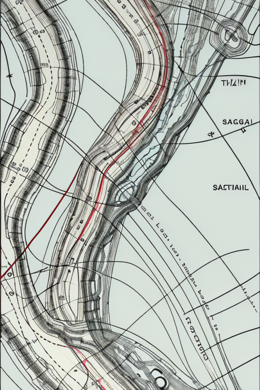
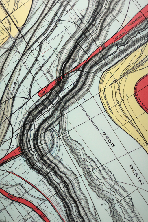
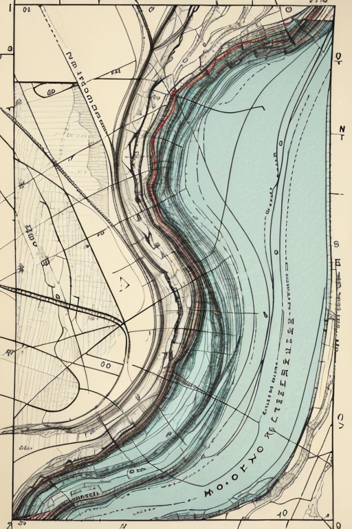
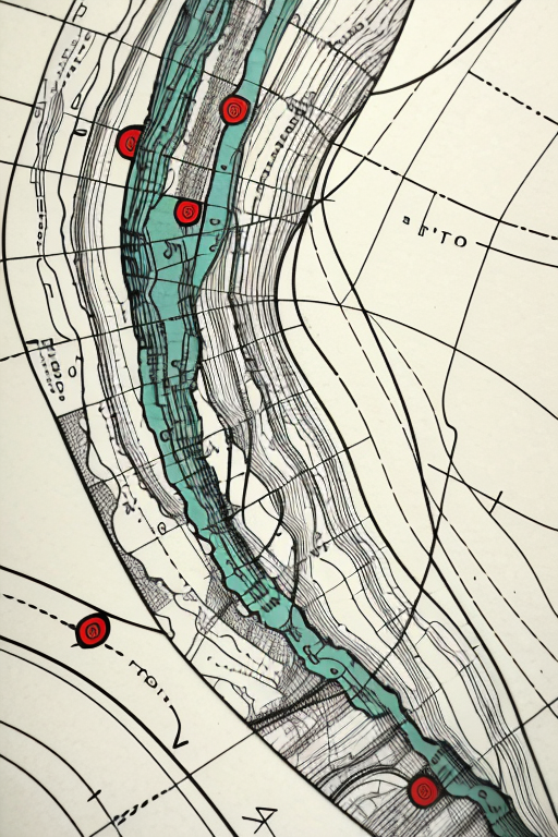
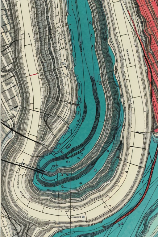
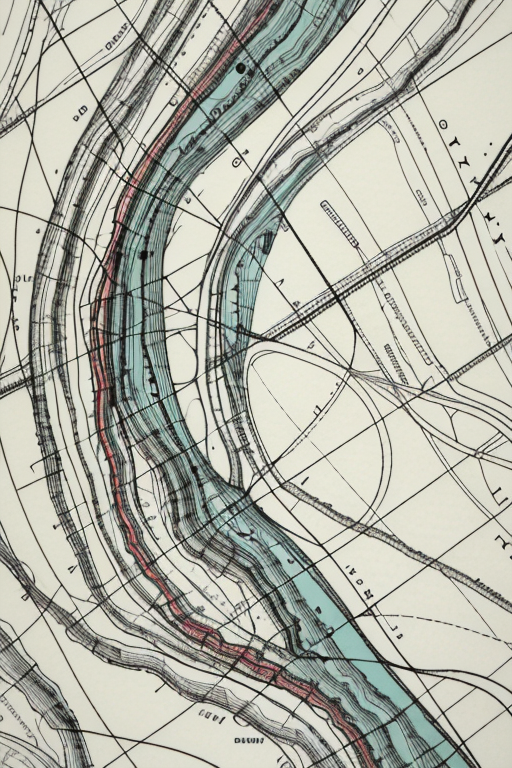
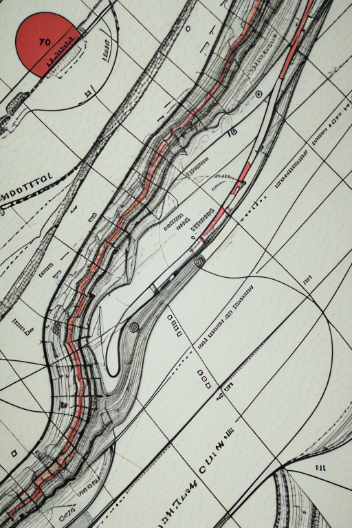
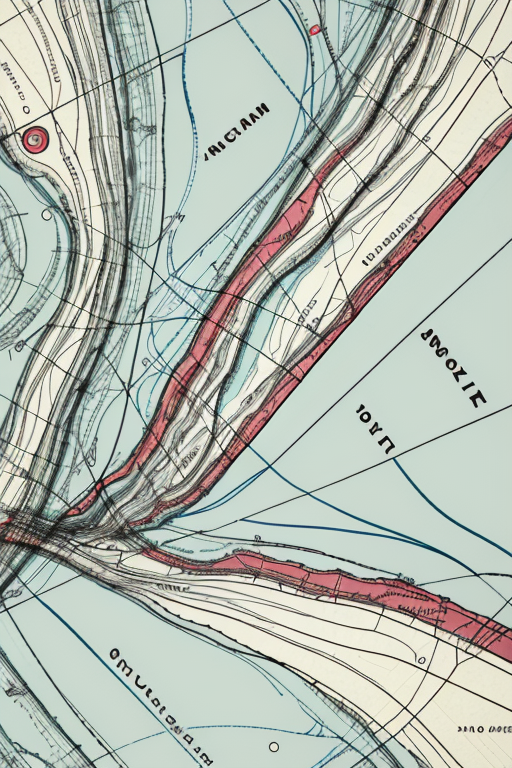
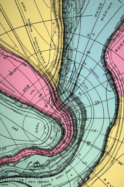
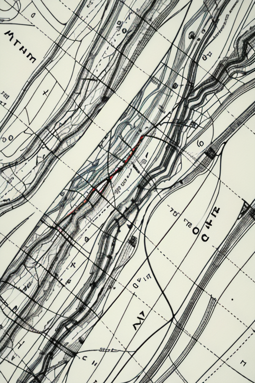
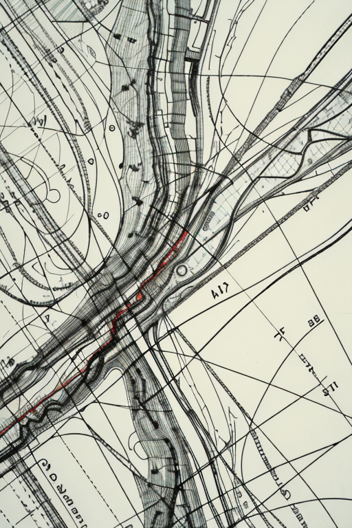
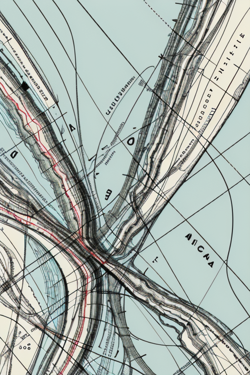
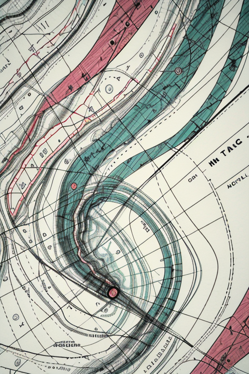
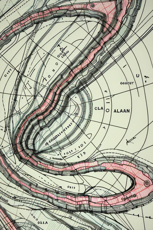
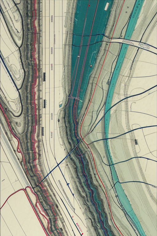
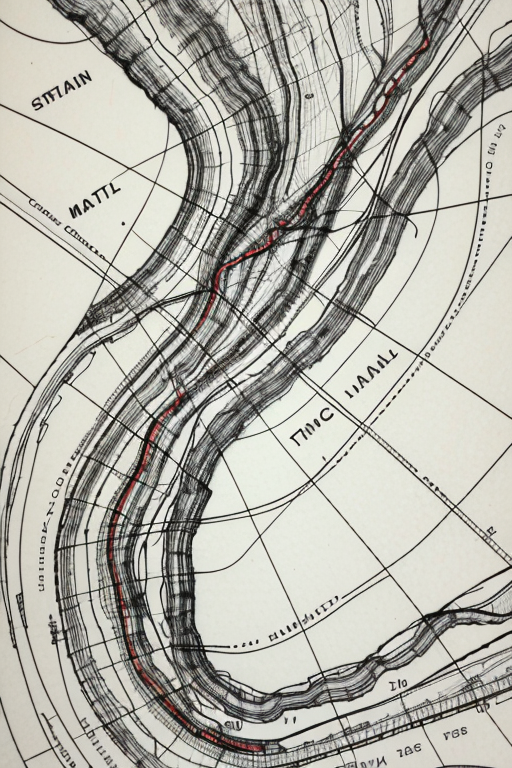

Harold Fisk (1908-1964) was a cartographer and geologist for the U.S. Army Corps of Engineers. In the early 1940s, he spent three years tracing the paths of the Mississippi River. Not just the current path — every path it had taken in the thousands of years it has wandered from the American Midwest to the Gulf of Mexico. Fisk assembled his findings into a series of colored plates published as part of 1944's Geological Investigation of the Alluvial Valley of the Lower Mississippi River. The multicolored maps — tracing Cape Girardeau, Missouri, to Donaldsonville, Louisiana — became legendary for their beauty. (You can see the originals, of which only 1,000 were printed, here.)
This embedding is trained on 30 segments of the Fisk plates — specifically, Sheet 7, along the Arkansas-Mississippi border — cooked for a total of 300 steps on base SD 1.5: 16 vectors per token, a 0.004 learning rate, a batch size of 6, and 5 gradient steps.
For a far more advanced way of paying procedural homage to Fisk's work, check out Robert Hodgin's Meander project, which creates new Fisk-inspired landscapes from scratch.
Your ratings, especially of the five-star variety, are very much appreciated.

First release.
1. The rights to reposted models belong to original creators.
2. Original creators should contact SeaArt.AI staff through official channels to claim their models. We are committed to protecting every creator's rights. Click to Claim
