banner_image ×
SeaArt AI Enterprise Version

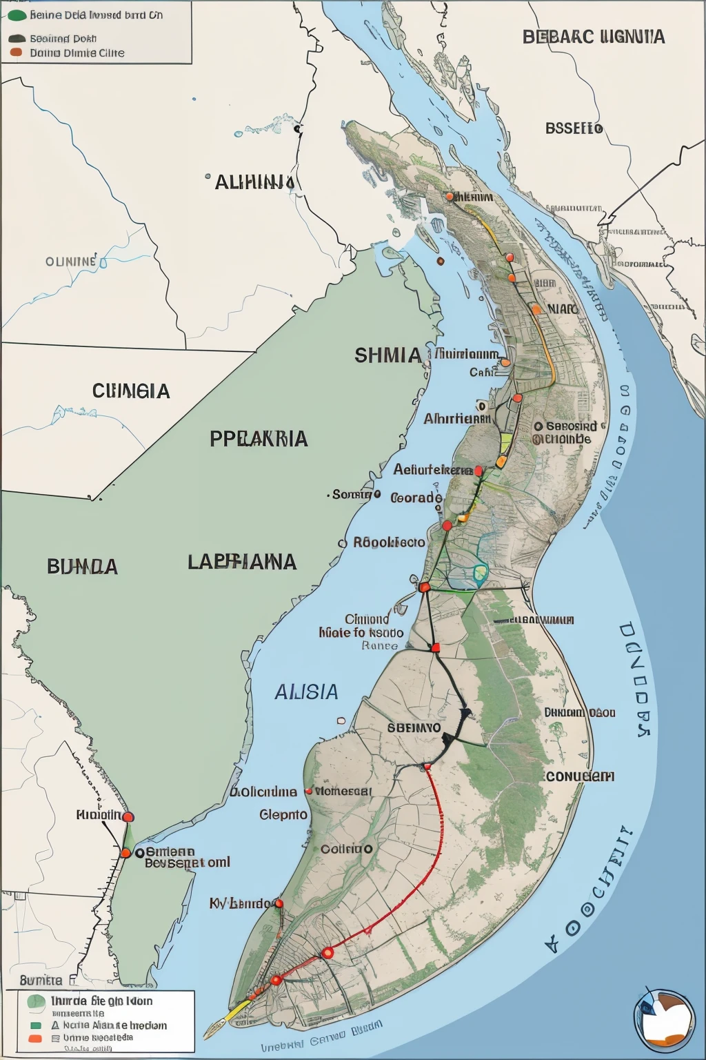
A map of the route from the north to the east

Alpharia is located in a diverse region, with coasts on the Alphar Sea to the east and mountains to the west.
En el mapa, You could highlight the eastern coast and the mountains on the western side.
Cities and Points of Interest:

La capital, Alpha City, could be marked with a dot or special symbol on the map to indicate its location.
Other points of interest, como ciudades importantes, Historic sites, national parks and tourist areas, They could also be marked on the map.
Divisiones Administrativas:

Alpharia could be divided into several regions or provinces. These divisions could be shown with different lines or colors on the map to distinguish them.
Each region or province could be clearly labeled on the map for easy identification.
Infraestructura:

Major roads and transportation routes could be represented on the map to show the country's infrastructure.
Besides, other infrastructure elements could be shown, como aeropuertos, seaports, and important railways.
Recursos Naturales:

Important natural resources could be indicated, like rivers, lagos, bosques, and agricultural areas.
The location of mineral or energy resources could also be represented., If it is relevant to the country's economy.
Leyenda y Escala:

A legend on the map could explain the symbols used and provide additional information about the elements represented.
A scale would be included to indicate the distance on the map.
chatIcon
Some things that can only be whispered here.
Create AI Character
image
avatar
J
Jhonu 33yt
Prompts
Copy
Alpharia is located in a diverse region , with coasts on the Alphar Sea to the east and mountains to the west . En el mapa , You could highlight the eastern coast and the mountains on the western side . Cities and Points of Interest: La capital , Alpha City , could be marked with a dot or special symbol on the map to indicate its location . Other points of interest , como ciudades importantes , Historic sites , national parks and tourist areas , They could also be marked on the map . Divisiones Administrativas: Alpharia could be divided into several regions or provinces . These divisions could be shown with different lines or colors on the map to distinguish them . Each region or province could be clearly labeled on the map for easy identification . Infraestructura: Major roads and transportation routes could be represented on the map to show the country&#39 ; s infrastructure . Besides , other infrastructure elements could be shown , como aeropuertos , seaports , and important railways . Recursos Naturales: Important natural resources could be indicated , like rivers , lagos , bosques , and agricultural areas . The location of mineral or energy resources could also be represented ., If it is relevant to the country&#39 ; s economy . Leyenda y Escala: A legend on the map could explain the symbols used and provide additional information about the elements represented . A scale would be included to indicate the distance on the map .
INFO
Prompts
Alpharia is located in a diverse region, with coasts on the Alphar Sea to the east and mountains to the west. En el mapa, You could highlight the eastern coast and the mountains on the western side. Cities and Points of Interest: La capital, Alpha City, could be marked with a dot or special symbol on the map to indicate its location. Other points of interest, como ciudades importantes, Historic sites, national parks and tourist areas, They could also be marked on the map. Divisiones Administrativas: Alpharia could be divided into several regions or provinces. These divisions could be shown with different lines or colors on the map to distinguish them. Each region or province could be clearly labeled on the map for easy identification. Infraestructura: Major roads and transportation routes could be represented on the map to show the country's infrastructure. Besides, other infrastructure elements could be shown, como aeropuertos, seaports, and important railways. Recursos Naturales: Important natural resources could be indicated, like rivers, lagos, bosques, and agricultural areas. The location of mineral or energy resources could also be represented., If it is relevant to the country's economy. Leyenda y Escala: A legend on the map could explain the symbols used and provide additional information about the elements represented. A scale would be included to indicate the distance on the map.
Negative Prompts
cartoon, painting, illustration, (worst quality, low quality, normal quality:2)
CFG Scale
5
Steps
30
Sampler
DPM++ 2M Karras
Seed
1774764042
Clip Skip
2
Image Size
512 X 768
Denoising Strength
0.2
Model
epiCRealism
Generate
Size
1024X1536
Date
Apr 2, 2024
Mode
Default
Type
upscale
Checkpoint & LoRA
epiCRealism
Checkpoint
epiCRealism
#Landscape
#Cartoon
0 comment
0
0
0

SeaArt Swift AI Apps

ai_video_generationimg
AI Video Generation

Unleash your imagination and let AI create visual wonders for you

face_swap_titleimg
Face Swap Online Free

Create funny or realistic face swap videos & photos in a snap

fuse_anyoneimg
AI Image Fusion

Combine two images into new one stunning visual with AI Image Fusion.

ai_tools_2img
Remove Background

Remove backgrounds from any image in seconds.

cartoon_avatar_h1img
Cartoon Avatar Maker

Turn your photos into unique cartoon avatars instantly.

kiss_vidimg
AI Kissing Video Generator

Join the kissing trend with SeaArt's AI kissing video generator instantly. Easily make two people kiss, and create realistic animation.

Explore More AI Apps 

Explore Related

ControlNet
logo
English
Application
Create Image AI Characters Swift AI Model Training Canvas AI Apps Workflow
About
Studio Rankings AI Chat AI Blog AI News
Help
Guides Customer Service
Get App
icon
Download on the
APP Store
icon
GET IT ON
Google Play
Follow Us
iconiconiconiconiconiconiconicon
© 2025 SeaArt, Inc.
Copyright Policy
Terms
Privacy 特定商取引法 資金決済法に基づく表示
More